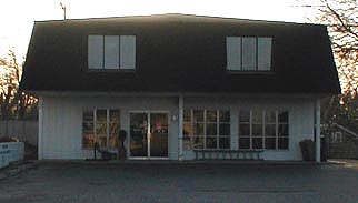
 Walking Tour-60 South Main Street-Walking Tour
(East Side of Street)
The building on this site now was built in 19? toward the rear of the Lot. Originally there was a house here, much closer to the street, which was probably built by/for Issac Linabury between 1850 &1854. The Lot became the property of N. D. Bingham in 1856 according to the tax records, and then Amanda Bingham until at least 1872. The house was a Greek Revival style structure with the 1 & 1/2 story street-facing gable section on the north and a single story wing to the south. A glimpse of the house may be seen in a photo of the Village circa 1900. See Heritage pg.19.
In the 1920s the house was owned by Mr. and Mrs. John Shaughnessey. Mr. Shaughnessey who had previously worked for the Clarkston Bakery used part of the house for his own bakery business. The family lived in the building also. Mr. Shaughnessey went to work for Rudy's after the Second World War.
Official Property Description:
- Lot 10 Block 8 of Nelson W. Clark's Original Plat of the Village in the Southeast 1/4 of Section 20 in Independence Towhship.
- Lot 61 of the Assessor's Plat.
Significant Property History:
[A Synopsis Of Property Transfers Derived From Abstracts
(when available) And Periodic Changes In Ownership Or
Assessed Value Derived From Township Tax Records]
- 1831 United States to Butler Holcomb.
- 1833 Butler Holcomb & wife, Mary, To Roswell/Roosevelt Holcomb, the west 1/2 of the Southeast 1/4 of Section 20.
- 1833 Butler Holcomb & wife, Mary, To Roswell/Roosevelt Holcomb, and wife, Elvine Holcomb, and Daniel B. Holcomb and wife, Alimira, to Jeremiah Clark, the south part of the west 1/2 of the Southeast 1/4 of Section 20.
- 1839 Jeremiah Clark to Nelson Washington Clark, the undivided 1/2 of the west 1/2 of the southeast 1/4 of Section 20 commencing.......
- 1842 Jeremiah Clark & wife, Polly, to Nelson W. Clark, the south part of the west 1/2 of the Southeast 1/4 of Section 20. Also other land.
- 1842 Jeremiah Clark & Nelson W. Clark to Village of Clarkston (Original plat of the Village).
- 1844 Isaac "Lennabury", Lot 10 Block 8, assessed value $100.
- 1847 Isaac Place, Lot 10 Block 8, assessed value $100.
- 1849 "Erwinn W. Millard", Lot 10 Block 8, assessed value $105.
- 1850 "Irwin W. Millan", Lot 10 Block 8, assessed value $115.
- 1855 Issac Linabury, assessed value $430.
- 1856 N. D. Bingham, Lot 10, assessed value $500, & Lot 9, assessed value $50.
- 1857 N. D. Bingham, Lots 9 &10, assessed value $50.
- 1858 Amanda Bingham, Lots 9 &10.
- 1872 Map of the Village has a building footprint, owner Mrs. Bingham.
- 1889 James Fair, Lot 10 Block 8, assessed value $450.
- 1910 James Fair, as above, assessed value $300.
- 1919 Robert Beardslee estate, Lot 10 Block 8, assessed vallue $700.
- 1925 A. Landi, Lot 10, assessed value $800.
- 1927 John Shaughnessey, assessed value $800.
- 1935 as above.
- 1935 as above, Lot 10, assessed value $600.
- 1954 J. Shaughnessey (but the Shaugnessy's daughter says the family moved in 1951.)
Site Conceived By
And Grant Funding Obtained By
Mollie Lynch, Library Director 1991-2005
Researched And Written By Susan K. Basinger
Web Pages Designed And Built By Bill And Susan
Basinger
Contents ©2000 Independence Township Library
All Rights Reserved

![]() Walking Tour-60 South Main Street-Walking Tour
Walking Tour-60 South Main Street-Walking Tour![]()

![]() Walking Tour-60 South Main Street-Walking Tour
Walking Tour-60 South Main Street-Walking Tour![]()